

Rain, not a confirmed cyclone, emerges as the immediate threat; IMD forecasts Deep Depression crossing between Visakhapatnam and Gopalpur
GTNS
SEPTEMBER 22, 2026 , BHUBANESWAR: Odisha’s weather has entered a high-alert phase with a depression over the Bay of Bengal moving towards the north Andhra Pradesh–south Odisha coast, bringing the possibility of intense rain, thunderstorms and difficult conditions along the coast and in southern districts.
The India Meteorological Department has forecast that the system will strengthen into a Deep Depression and is likely to cross between Visakhapatnam and Gopalpur during the night of September 23 and early hours of September 24.
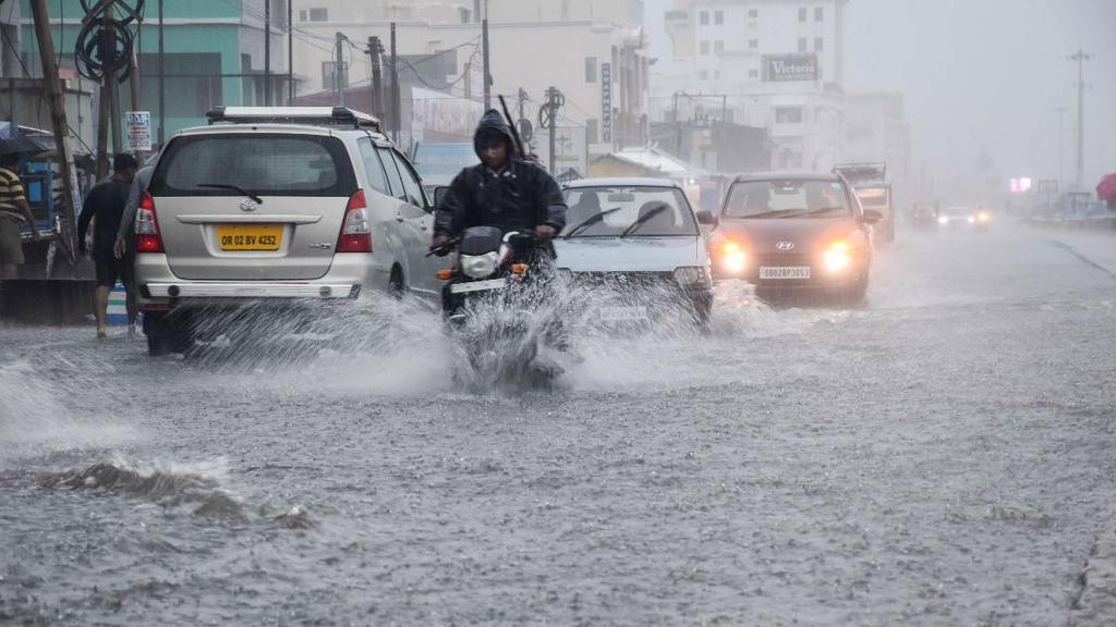
The developing system is already influencing weather over Odisha, with heavy rain reported across coastal and southern areas. The state’s concern now extends beyond rainfall itself to the possible chain reaction of waterlogging, flooding, landslides and disruption of transport.
RAINFALL ENTERS THE CRITICAL WINDOW
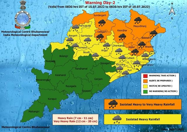
The latest IMD warning issued for Odisha puts very heavy rain on September 22, followed by extremely heavy rain on September 23 and 24. Very heavy rainfall remains possible on September 25, with heavy rain continuing as a possibility on September 26.
This makes Wednesday and Thursday the most closely watched days for the state.
For districts already experiencing saturated ground conditions, additional intense rainfall could rapidly worsen local water accumulation and drainage problems.
SOUTHERN DISTRICTS FACE THE GREATEST CONCERN
Southern and south-coastal Odisha are likely to remain at the centre of the weather response as the system approaches.
Areas vulnerable to flooding and landslides will require particular attention, especially where heavy rain falls over short periods.
The administration is therefore preparing not simply for the movement of the weather system but for its possible effects on roads, settlements, rivers, reservoirs and public infrastructure.
COASTAL WEATHER TO TURN ROUGHER
The IMD coastal bulletin has warned of rain and thunderstorms along Odisha’s coast, with sea conditions becoming moderate to rough. Local Cautionary Signal No. III has been hoisted at Odisha ports.
For coastal communities, fishermen and small boats, deteriorating sea conditions remain a major safety concern.
SCHOOLS SHUT AS PRECAUTION
The weather warning has already affected normal life.
Schools and Anganwadi centres have been ordered closed in several districts, including Khurda, Jagatsinghpur, Ganjam and Gajapati, according to reports on the state government’s precautionary measures.
The decision is intended to reduce exposure during the period when heavy to extremely heavy rainfall is expected.
STATE MACHINERY MOVES INTO PREPAREDNESS MODE
The Odisha administration has increased preparedness in vulnerable areas, including deployment and readiness of response teams, shelter arrangements and monitoring of locations that could face flooding or landslides.
Government employees’ leave has also been cancelled as part of the preparedness measures reported on Tuesday.
The objective is to ensure that emergency personnel and district-level machinery remain available if conditions deteriorate rapidly.
THE CYCLONE QUESTION
Despite public discussion about a possible cyclone, the current official position is more specific.
The system is presently a Depression, and IMD forecasts strengthening into a Deep Depression. The official coastal forecast currently expects it to cross the north Andhra Pradesh–south Odisha coast in that category.
Therefore, there is no basis in the current IMD bulletin to call it a confirmed cyclone.
That distinction matters because the immediate hazard assessment is being driven largely by rainfall and associated flooding risks.
WHAT THE NEXT TWO DAYS COULD BRING
The weather system’s movement will determine how rainfall is distributed across Odisha. Even after the coastal crossing, rain-related problems may persist because runoff can continue feeding rivers, drains and low-lying areas.
People living near rivers, streams, steep slopes and low-lying settlements should remain alert and follow instructions from district authorities.
PUBLIC SAFETY MESSAGE
Residents should avoid unnecessary travel during periods of intense rain, stay away from flooded roads and swollen water channels, and follow evacuation instructions if issued.
Fishermen should remain away from the sea while adverse conditions persist.
For the latest changes in track, intensity and rainfall warnings, residents should rely on official IMD and district administration bulletins.
GTNS WEATHER DESK | BHUBANESWAR